Mount Adams 5774 ft.
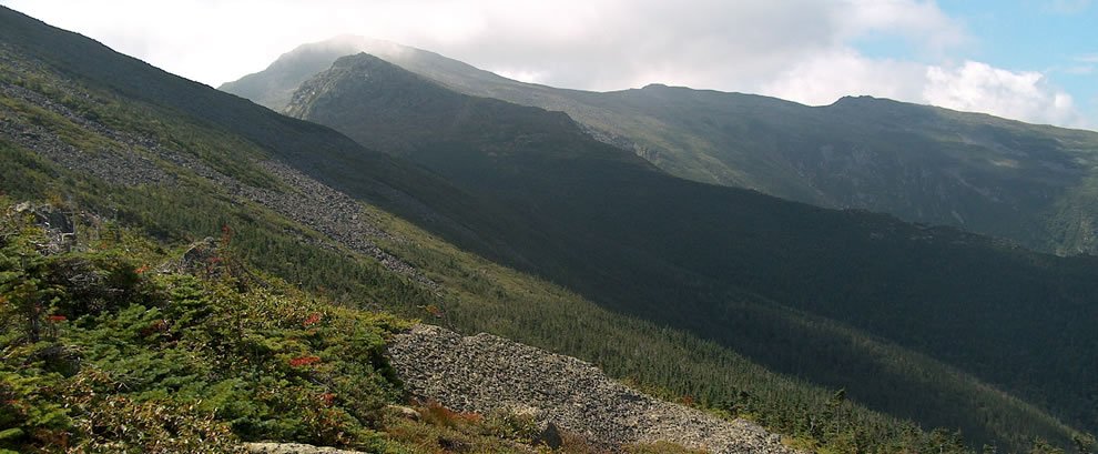
Mt. Adams is located in some of the most difficult terrain in New Hampshire and is the second highest peak in the Mount Washington Valley. Unlike Mt. Washington, Mt.Adams has several camping sites located on the mountain itself which makes it a popular destination for hikers including those traveling the Appalanchian Trail. The Randolph Mountain Club cares for shelters on the North side of Adams. These shelters; Gray Knob, Crag Camp, the Perch and the Log Cabin are on a first come first serve basis. There is additional camping in the Great Gulf Wilderness on the south side of Adams.
The Appalachian Mountain Club (AMC) runs the Mt. Madison Springs Hut, on the North East side of Adams and only a short distance from the Adams and Madison summits. The Valley Way is one of the most popular routes to Madison Hut and then to the rocky summit of Mt.Adams. The Airline Trail is a massive ridge towering over King Ravine, one of the most exciting Presidential ravines with an exciting boulder field and ice caves. Be sure to hike safe and follow the cairnsabove tree line because like Mt. Jefferson, Adams summit is surrounded by several other peaklets often obscuring the true summit.
Quick Trail Facts:
Valley Way Trail: One of the most well used and protected trails from Appalachia parking lot, this trail climbs steadily to Madison Hut. From there to Gulfside Trail, on to the Airline trail and take that directly to the summit.
Distance to summit: 4.7 miles.
Approx. 5 hours
Lowe's Path Trail: The most popular route to the summit of Adams. It starts across Rt 2 from Lowe's Store where parking is available for a small fee. This trail is gradual at first, then getting steeper. This trail is the shortest trail to Gray Knob cabin. Above there the trail is above treeline and on to the summit.
Distance to summit: 4.7 miles.
Approx. 5 hours.
Airline Trail: A direct and exposed route with excellent views; avoid this trail in bad weather. Starting from Appalachia and up Durand Ridge this trail climbs very quickly to above treeline at about 3 miles. From there it stays on Durand Ridge to the Knife Edge and then climbing the rocky summit cone.
Distance to summit: 4.3 miles.
Aprox. 5 hours.
King Ravine Trail : This is one of the more advanced routes up to the summit of Mt. Adams. The King Ravine headwall is strenuous and challenging. Should not be attempted in wet weather. From Appalachia go up the Airline to Shortline to Randolph Path, eventually hitting the King Ravine trail at 2.7 miles. The Headwall is steep and rough. Should not use this trail upon decent. The scenery is magnificent.
Approx. 4 hours (not including summit)